8


CATEDRA DE CLIMATOLOGIA
TRABAJO PRACTICO 5
IGNACIO GATTI
Los sistemas de información geográfica (SIG) y conceptos
climatológicos

USO DE SISTEMAS DE INFORMACION GEOGRAFICA
EN CLIMATOLOGÍA
http://www.globalclimatemonitor.org/
CAPAS
SISTEMA DE COORDENADAS

USO DE SISTEMAS DE INFORMACION GEOGRAFICA
EN CLIMATOLOGÍA
http://www.globalclimatemonitor.org/
Bajar cobertura en formato SHAPE

Manejo de Qgis
• Abrimos el programa a y nos aparece esta interface inicial
Agregar capas
Barra de herramientas
Sistemas de coord
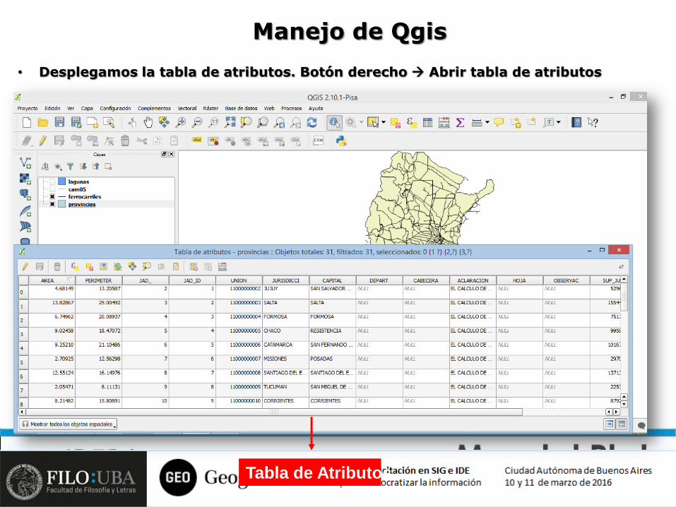
Tabla de Atributos
Manejo de Qgis
• Desplegamos la tabla de atributos. Botón derecho Abrir tabla de atributos

• Podemos modificar la leyenda para elegir la cantidad de decimales deseados.
para eso vuelvo a Propiedades de la capa, estilo y modifico la leyenda haciendo
click (1)

• Mapa final, listo para exportar.


